2 New Tools Can Cut Deforestation and Support Sustainable Palm Oil in Indonesia
Can the world have its palm oil and forests, too? This is an issue that my colleague and I discussed a while back. I am pleased to say that we recently moved a step toward ensuring that the answer is “yes.”
At the 10th Annual Meeting of the Roundtable on Sustainable Palm Oil (RSPO), WRI launched two new online mapping applications designed to help the palm oil industry grow while avoiding deforestation. These free tools enable palm oil producers, buyers, investors, and government agencies to easily identify and evaluate locations in Indonesia where they can develop plantations on already-degraded land rather than on currently forested areas. By siting oil palm plantations on degraded or “low-carbon” lands, developers can avoid the need to clear remaining natural forests to meet the growing global demand for palm oil.
Introducing the “Forest Cover Analyzer” and “Suitability Mapper”
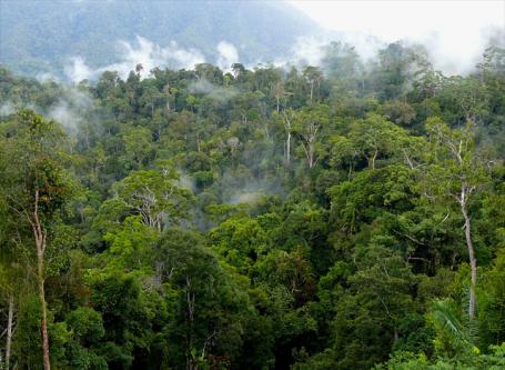
The first application, the Forest Cover Analyzer, allows users to assess forest cover, forest cover change, and legal status in Indonesian Borneo. For the first time, companies can conduct their own online assessments to identify risks to sustainable palm oil production in a particular area. For example, users can determine whether a specific tract is likely to contain high-conservation value forest, or if it would be difficult to develop the area according to RSPO principles and criteria. By providing transparent and objective data on forest cover change, the Analyzer creates an incentive to avoid forested areas when establishing plantations.
The second application, the Suitability Mapper, allows palm oil producers, investors, and government spatial planners to locate tracts of low-carbon “degraded lands” that are potentially suitable for sustainable oil palm production. By “degraded,” we mean land where the natural vegetation—typically forests—was cleared years ago and where the forests did not recover. “Degraded” in this sense does not mean “poor soil quality,” but rather that the area has low carbon stocks, little biodiversity, and is not currently under cultivation. Alang-alang grasslands are an example of such areas in Indonesia.
The Suitability Mapper allows users to create and customize maps of potentially suitable degraded lands by applying a suite of objective criteria, such as land cover type (e.g., forest), peat depth, conservation areas, elevation, slope, rainfall, soil type, soil acidity, and more. WRI and its Indonesian partner, Sekala, developed the application to be consistent with international sustainability standards—such as those of the RSPO—and Indonesian laws and regulations. WRI and Sekala design the application with input from industry, government agencies, NGOs, and other experts. It currently covers Indonesian Borneo, but work is already underway to expand coverage to other Indonesian islands.
Watch a video preview of the Suitability Mapper and Forest Cover Analyzer.
Using Degraded Lands
The Suitability Mapper suggests that more than 14 million hectares of land in the Kalimantan region of Borneo may be suitable for sustainable palm oil production. Now, not all of these hectares should necessarily become plantations; local people may not want particular tracts to go into oil palm. But the scale of potential is interesting. For comparison, experts have predicted a total of 3 to 7 million hectares of oil palm cultivation expansion in all of Indonesia by 2020. These comparable sizes suggest that palm oil needs could be met without clearing another hectare of forest or draining more peatland.
Of course, even the most useful mapping applications are not enough to ensure that all future oil palm plantations are sited on low-carbon, degraded lands. Good land use planning and permitting processes, effective law enforcement, and other good governance practices are needed as well. And reliable, transparent information can contribute to these efforts.
A Scalable Solution
Restoring the productivity of degraded lands to absorb agricultural expansion can break the link between oil palm expansion and deforestation. Yet this strategy is not just relevant to Indonesia. As palm oil expands into Africa and Latin America, siting plantations on low-carbon degraded lands would enable the industry to grow sustainably, with increased production, new jobs, and no deforestation.
And this strategy is not just relevant to palm oil. Degraded lands can be restored back into productivity for other commodities, too, such as soya and cattle. Brazil, for instance, has millions of hectares of degraded pasturelands that, if restored, could enable the country to increase its cattle production without the need to cut down more of the Amazon.
So, can you imagine a future where increased demand for palm oil, beef, and soya is met not by clearing tropical forests, but by bringing degraded lands back into productivity? I can.
For more information on the new mapping applications and using degraded land to sustainably produce palm oil, visit WRI's Project POTICO website.