Making Big Ideas Happen

Resources

Tags

17 Resources for
Life at WRI Indonesia

WRI Indonesia Development Strategy in Papua

  • local impacts
  • Papua
  • Life at WRI Indonesia
Membangun kepercayaan organisasi masyarakat sipil Papua penting untuk menghasilkan dampak yang besar. Foto: Rizky Haryanto/WRI
  • local impacts
  • Papua
  • Life at WRI Indonesia

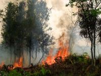
6 Graphics Explain the Climate Feedback Loop Fueling US Fires

  • Climate
  • climate
  • emissions
  • Fires
  • forest
  • local impacts
  • United States
Bobcat Fire, as seen from Monrovia, California. Photo by Eddiem360/Wikimedia Commons
  • Climate
  • climate
  • emissions
  • Fires
  • forest
  • local impacts
  • United States
Life at WRI Indonesia

Steps to Continue Our Real Actions on the Field During a Pandemic

  • agroforestry
  • forest
  • local impacts
  • peatland
  • Life at WRI Indonesia
Bibit untuk rehabilitasi Hutan Desa Tandun (Sumber foto: Ali Imran)
  • agroforestry
  • forest
  • local impacts
  • peatland
  • Life at WRI Indonesia
Insights
The IPCC finds that limiting global temperature rise to 1.5°C will bring less severe impacts than if the world warms by 2°C. Photo by Mass Communication Specialist 2nd Class William Ramsey/U.S. Navy
  • climate change
  • climate science
  • IPCC
  • local impacts
Insights

8 Things You Need to Know About the IPCC 1.5˚C Report

  • adaptation
  • climate change
  • climate science
  • emissions
  • IPCC
  • local impacts
The world is way off track from its agreed-upon goal of limiting warming to 1.5˚C-2˚C (2.7-3.6˚ F). Photo by Chistopher Michel/Wikimedia Commons
  • adaptation
  • climate change
  • climate science
  • emissions
  • IPCC
  • local impacts
Insights

Visualizing a Warmer World: 10 Maps of Climate Vulnerability

  • adaptation
  • climate change
  • local impacts
  • Mapping
  • adaptation
  • climate change
  • local impacts
  • Mapping

A One True Map, Not a No-one's Map

  • governance
  • maps
  • governance
  • maps

Destruction of Tropical Peatland Is an Overlooked Source of Emissions

  • agriculture
  • deforestation
  • degraded land
  • Indonesia
  • Mapping
  • maps
  • palm oil
Peat drainage canals, combined with fire, are used to make land more suitable for agriculture. Photo by Nancy Harris/Flickr
  • agriculture
  • deforestation
  • degraded land
  • Indonesia
  • Mapping
  • maps
  • palm oil
Insights

When Could the Paris Agreement Take Effect? Interactive Map Sheds Light

  • climate
  • climate data
  • COP21
  • international climate policy
  • Mapping
  • maps
  • Paris Agreement
  • UNFCCC
The Paris Agreement Tracker enables people to monitor countries’ progress toward ratifying the Paris Agreement, and allows users to create their own combinations for bringing it into force.
  • climate
  • climate data
  • COP21
  • international climate policy
  • Mapping
  • maps
  • Paris Agreement
  • UNFCCC

Linking Products to Places: The Initiatives Working to End Deforestation

  • agriculture
  • business
  • business opportunity
  • business risk
  • corporate sustainability
  • deforestation
  • forests
  • maps
  • palm oil
Harvesting logs in Malaysia. Photo by Wakx/Flickr
  • agriculture
  • business
  • business opportunity
  • business risk
  • corporate sustainability
  • deforestation
  • forests
  • maps
  • palm oil

What Indonesia Doesn’t Know About Peatlands Could Undermine its Climate Goals

  • climate change
  • deforestation
  • emissions
  • forests
  • Indonesia
  • Indonesian Peat Prize
  • maps
  • peat
  • peatland
  • wetlands
Peat swamp forests of the Katingan Peatland Reserve in Central Kalimantan, Indonesia. Photo by James Anderson/WRI
  • climate change
  • deforestation
  • emissions
  • forests
  • Indonesia
  • Indonesian Peat Prize
  • maps
  • peat
  • peatland
  • wetlands
Insights

Leveraging the Power of the Crowd to Identify Illegal Land and Forest Fires in Indonesia

  • forests
  • Indonesia
  • Indonesia forest fires
  • maps
Forest fire in Palangkaraya, Central Kalimantan, Indonesia. Photo by CIFOR/Flickr.
  • forests
  • Indonesia
  • Indonesia forest fires
  • maps

Counting Trees to Save the Woods: Using Big Data to Map Deforestation

  • Climate
  • climate
  • climate change
  • climate data
  • deforestation
  • forest restoration
  • forests
  • Global Forest Watch (GFW)
  • maps
What can other big data initiatives seeking to combat climate change learn from Global Forest Watch? Photo credit: CIAT/Flickr
  • Climate
  • climate
  • climate change
  • climate data
  • deforestation
  • forest restoration
  • forests
  • Global Forest Watch (GFW)
  • maps

New Palm Oil Production Maps Mark a Milestone in Transparency

  • deforestation
  • forests
  • maps
  • palm oil
  • transparency
Most palm oil comes from Indonesia and Malaysia. Photo credit: Achmad Rabin Taim/Wikimedia Commons
  • deforestation
  • forests
  • maps
  • palm oil
  • transparency

9 Maps that Explain the World's Forests

  • deforestation
  • forests
  • maps
  • palm oil
Global Forest Watch is an online forest monitoring system created by the World Resources Institute and more than 40 partners. Photo credit: Marco Simola/CIFOR
  • deforestation
  • forests
  • maps
  • palm oil

New High-Resolution Forest Maps Reveal World Loses 50 Soccer Fields of Trees Per Minute

  • forests
  • Global Forest Watch (GFW)
  • maps
  • monitoring
  • forests
  • Global Forest Watch (GFW)
  • maps
  • monitoring