Resources
January 27, 2015
Governance of Forests Initiative Indicator Framework (Version 1)
January 4, 2015
Surveying Risk, Building Opportunity
January 4, 2015
Tracking Transformative Forest Actions to Reduce Emissions
January 4, 2015
Weeding Risk
December 30, 2014
Breaking the Logjam
December 28, 2014
The State of the Forest
November 1, 2014
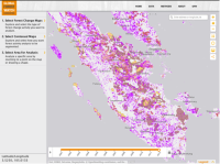
Painting the Global Picture of Tree Cover Change
November 1, 2014
Securing Rights, Combating Climate Change
November 1, 2014
Environmental Stories to Watch in 2008
September 4, 2014
8 Percent of World's Remaining Pristine Forests Degraded Since 2000
July 23, 2014
Infographic: Securing Rights, Combating Climate Change