Skip to main content
Accessibility
WRI Indonesia
Making Big Ideas Happen
Main navigation
Topics
Projects
Insights
Publications
Click to see more
Secondary Navigation
About
Our Approach
Donate
Subscribe
Subscribe
Quick Links
Quick Links
News
Resources
Experts & Staff
Events
Careers
Click to see more
Main navigation
Topics
Projects
Insights
Publications
Footer menu - secondary
Our Work
Topics
Energy
Forest & Land Use
Climate
Cities & Transportation
Ocean
Mega Menu
About
Our Approach
Mission & Goals
Values
Board of Advisors
History
Annual Reports
Procurement Opportunities
Join Us
Careers
Contact
Events
What can we help you find?
Back
Language switcher
Indonesian
English
Search
Not sure where to find something? Search all of the site's content.
What can we help you find?
Resources
All Topics
All Topics
Forests & Land Use
Filters
Filter Results
Sort
Featured
Most Recent
Alphabetical
Region
Africa
Amazon
Argentina
Asia
Australia
Bolivia
Brazil
Caribbean
China
Costa Rica
Democratic Republic of the Congo
Europe
Germany
Ghana
India
Indonesia
Japan
Latin America
Malaysia
Mexico
Morocco
Nepal
New Zealand
Nicaragua
North America
Papua New Guinea
Paraguay
Peru
Philippines
Puerto Rico
Russia
South Africa
South America
Southeast Asia
Switzerland
United States
Tags
access to information
adaptation and the private sector
agriculture
Asia
business
Climate
climate change
coral reefs
data
deforestation
degraded land
economic valuation
ecosystem services
Endangered Species
energy
extreme weather
finance
fire
fisheries
forest
forests
Global Forest Watch (GFW)
governance
Indonesia
Indonesia forest fires
investment
Mapping
maps
markets
natural resources
palm oil
POTICO
transparency
water
3 Resources
for
Malaysia
Mapping
Indonesia
Malaysia
Insights
July 7, 2016
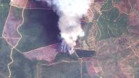
As Indonesia’s Dry Season Looms, a New Tool Can Predict Daily Forest Fire Risk
agriculture
deforestation
forest
Indonesia
Indonesia forest fires
Mapping
agriculture
deforestation
forest
Indonesia
Indonesia forest fires
Mapping
Forests & Land Use
Indonesia
Malaysia
Insights
April 21, 2016
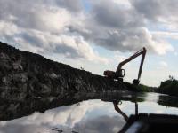
Destruction of Tropical Peatland Is an Overlooked Source of Emissions
agriculture
deforestation
degraded land
Indonesia
Mapping
maps
palm oil
agriculture
deforestation
degraded land
Indonesia
Mapping
maps
palm oil
Forests & Land Use
India
Indonesia
Malaysia
Nepal
Insights
April 1, 2016
We Can Save Tigers from Extinction, with a Little Help from Satellites
deforestation
Endangered Species
forests
Mapping
deforestation
Endangered Species
forests
Mapping