Resources
January 24, 2018
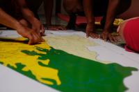
Women and 3D Mock-Up


December 14, 2017
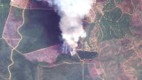
Places to Watch: 5 Forests at Risk This Month

December 5, 2017
3 Ways Governments Can Prevent Fake Data on Forests

November 30, 2017
Information Transparency and Time Stamps
September 24, 2016
Why sustainable diets are a big deal for humanity?

September 24, 2016
Opposing a Contempt of State with One Map

May 9, 2016
Incorrect Data and Fallacious Policy


April 30, 2014
Global Forest Watch
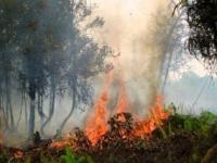
October 8, 2013
ASEAN Leaders Can Act to Reduce Fires and Haze