Making Big Ideas Happen

Resources

Type of Resource

Tags

21 Resources for

Mapping, Management, and Mitigation: How Peatlands Can Advance Climate Action in Southeast Asia

  • climate
  • Indonesian Peat Prize
  • Mapping
  • peat
  • peatland
Despite playing a major role in climate action, peatlands have been deforested and drained for agricultural lands. Photo credit: Nanang Sujana/CIFOR
  • climate
  • Indonesian Peat Prize
  • Mapping
  • peat
  • peatland

Places to Watch Fifth Edition: Five Indicated Illegal Logging Area in Indonesia

  • deforestasi
  • forest products
  • governance
  • pantaujejak
Verifikasi lapangan dan tindakan untuk mencegah perluasan kegiatan penebangan hutan ilegal di kelima wilayah terindikasi. Kredit foto: Martin Bamford/Flickr
  • deforestasi
  • forest products
  • governance
  • pantaujejak

The World Lost a Belgium-sized Area of Primary Rainforests Last Year

  • deforestation
  • Global Forest Watch (GFW)
  • Mapping
Primary rainforests are critically important for storing carbon and providing habitat for jaguars, orangutans, gorillas and other animals. Photo by stokpic/Pixabay
  • deforestation
  • Global Forest Watch (GFW)
  • Mapping

Places to Watch Fourth Edition: Five Indicated Illegal Logging Area in Indonesia

  • deforestasi
  • forest products
  • governance
  • pantaujejak
Penebangan hutan secara ilegal adalah penebangan pohon dalam kawasan hutan tanpa izin yang sah atau dengan izin yang sah namun tidak sesuai dengan ketentuan dalam izin. Kredit foto: Chris Alban Hansen/Flickr
  • deforestasi
  • forest products
  • governance
  • pantaujejak
Insights

Making Food Production and Land Use More Sustainable Could Yield $2.3 Trillion in Economic Benefits

  • deforestation
  • degraded land
  • economic valuation
  • food
  • forest products
  • land rights
  • land tenure
  • landscape restoration
Harvesting oil palm in Indonesia. Photo by Aul Rah/Flickr
  • deforestation
  • degraded land
  • economic valuation
  • food
  • forest products
  • land rights
  • land tenure
  • landscape restoration
Insights

Places to Watch Second Edition: Five Indicated Illegal Logging Area in Indonesia

  • deforestasi
  • forest products
  • pantaujejak
Foto oleh Fostive Visual untuk WRI Indonesia
  • deforestasi
  • forest products
  • pantaujejak

Power Plants Use Water, But We Have No Idea How Much

  • Climate
  • coal
  • Mapping
  • oil and gas
  • water
  • water risk
  • water stress
  • Climate
  • coal
  • Mapping
  • oil and gas
  • water
  • water risk
  • water stress
Insights

Visualizing a Warmer World: 10 Maps of Climate Vulnerability

  • adaptation
  • climate change
  • local impacts
  • Mapping
  • adaptation
  • climate change
  • local impacts
  • Mapping
Life at WRI Indonesia

Women and 3D Mock-Up

  • Climate
  • forests
  • gender
  • Mapping
  • Life at WRI Indonesia
  • Climate
  • forests
  • gender
  • Mapping
  • Life at WRI Indonesia

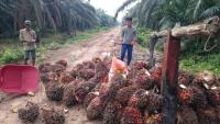
Toratima Coffee and Valuation of Environmental Services

  • economic valuation
  • environmental services
  • forest products
  • forests
  • economic valuation
  • environmental services
  • forest products
  • forests

5 Maps Show How Important Indigenous Peoples and Local Communities Are to the Environment

  • Forests & Land Use
  • Climate
  • deforestation
  • human rights
  • indigenous people
  • land rights
  • land tenure
  • Mapping
  • Forests & Land Use
  • Climate
  • deforestation
  • human rights
  • indigenous people
  • land rights
  • land tenure
  • Mapping

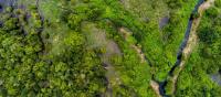
Places to Watch: 5 Forests at Risk This Month

  • deforestation
  • forests
  • Global Forest Watch (GFW)
  • Mapping
  • deforestation
  • forests
  • Global Forest Watch (GFW)
  • Mapping

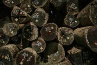
3 Ways Governments Can Prevent Fake Data on Forests

  • data
  • deforestasi
  • deforestation
  • forests
  • Indonesia
  • Mapping
  • data
  • deforestasi
  • deforestation
  • forests
  • Indonesia
  • Mapping

Opposing a Contempt of State with One Map

  • forest
  • Mapping
  • forest
  • Mapping
  • deforestation
  • forest
  • Mapping
  • water
  • water risk
Insights

As Indonesia’s Dry Season Looms, a New Tool Can Predict Daily Forest Fire Risk

  • agriculture
  • deforestation
  • forest
  • Indonesia
  • Indonesia forest fires
  • Mapping
  • agriculture
  • deforestation
  • forest
  • Indonesia
  • Indonesia forest fires
  • Mapping

Destruction of Tropical Peatland Is an Overlooked Source of Emissions

  • agriculture
  • deforestation
  • degraded land
  • Indonesia
  • Mapping
  • maps
  • palm oil
Peat drainage canals, combined with fire, are used to make land more suitable for agriculture. Photo by Nancy Harris/Flickr
  • agriculture
  • deforestation
  • degraded land
  • Indonesia
  • Mapping
  • maps
  • palm oil
Insights

When Could the Paris Agreement Take Effect? Interactive Map Sheds Light

  • climate
  • climate data
  • COP21
  • international climate policy
  • Mapping
  • maps
  • Paris Agreement
  • UNFCCC
The Paris Agreement Tracker enables people to monitor countries’ progress toward ratifying the Paris Agreement, and allows users to create their own combinations for bringing it into force.
  • climate
  • climate data
  • COP21
  • international climate policy
  • Mapping
  • maps
  • Paris Agreement
  • UNFCCC

We Can Save Tigers from Extinction, with a Little Help from Satellites

  • deforestation
  • Endangered Species
  • forests
  • Mapping
  • deforestation
  • Endangered Species
  • forests
  • Mapping