Making Big Ideas Happen

Resources

Tags

Destruction of Tropical Peatland Is an Overlooked Source of Emissions

  • agriculture
  • deforestation
  • degraded land
  • Indonesia
  • Mapping
  • maps
  • palm oil
Peat drainage canals, combined with fire, are used to make land more suitable for agriculture. Photo by Nancy Harris/Flickr
  • agriculture
  • deforestation
  • degraded land
  • Indonesia
  • Mapping
  • maps
  • palm oil

We Can Save Tigers from Extinction, with a Little Help from Satellites

  • deforestation
  • Endangered Species
  • forests
  • Mapping
  • deforestation
  • Endangered Species
  • forests
  • Mapping

Linking Products to Places: The Initiatives Working to End Deforestation

  • agriculture
  • business
  • business opportunity
  • business risk
  • corporate sustainability
  • deforestation
  • forests
  • maps
  • palm oil
Harvesting logs in Malaysia. Photo by Wakx/Flickr
  • agriculture
  • business
  • business opportunity
  • business risk
  • corporate sustainability
  • deforestation
  • forests
  • maps
  • palm oil

What Indonesia Doesn’t Know About Peatlands Could Undermine its Climate Goals

  • climate change
  • deforestation
  • emissions
  • forests
  • Indonesia
  • Indonesian Peat Prize
  • maps
  • peat
  • peatland
  • wetlands
Peat swamp forests of the Katingan Peatland Reserve in Central Kalimantan, Indonesia. Photo by James Anderson/WRI
  • climate change
  • deforestation
  • emissions
  • forests
  • Indonesia
  • Indonesian Peat Prize
  • maps
  • peat
  • peatland
  • wetlands
Insights

With Latest Fires Crisis, Indonesia Surpasses Russia as World’s Fourth-Largest Emitter

  • agriculture
  • deforestation
  • Indonesia
  • Indonesia forest fires
  • palm oil
  • agriculture
  • deforestation
  • Indonesia
  • Indonesia forest fires
  • palm oil
Insights

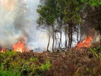
3 Ways Obama Could Help Fight Indonesia's Massive Fires

  • deforestation
  • forests
  • Indonesia forest fires
Fires in Indonesia are creating haze throughout Southeast Asia. Photo by Rini Sulaiman/ Norwegian Embassy for Center for International Forestry Research (CIFOR)
  • deforestation
  • forests
  • Indonesia forest fires

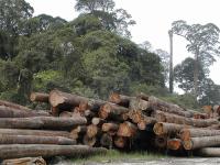
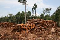
Brazil and Indonesia Struggling to Reduce Deforestation

  • deforestation
  • forests
  • Global Forest Watch (GFW)
Cleared rainforest in West Kalimantan, Indonesia. Photo by Rainforest Action Network/Flickr
  • deforestation
  • forests
  • Global Forest Watch (GFW)

Having it All: Indonesia Can Produce Palm Oil, Protect Forests and Reap Profits

  • agriculture
  • deforestation
  • forests
  • Indonesia
  • palm oil
Agricultural development is the largest driver of deforestation in Indonesia. Photo by Achmad Rabin Taim/Wikimedia Commons.
  • agriculture
  • deforestation
  • forests
  • Indonesia
  • palm oil

Forest Fires Blaze in Indonesia’s Tesso Nilo National Park

  • deforestation
  • emissions
  • fire
  • forests
  • Indonesia
  • Indonesia forest fires
  • palm oil
Tesso Nilo is home to endangered species like the Sumatran tiger. Photo by Steve Wilson/Flickr
  • deforestation
  • emissions
  • fire
  • forests
  • Indonesia
  • Indonesia forest fires
  • palm oil

Indonesia’s Forest Fires Reignite, Threatening Protected Areas and Peatlands

  • agriculture
  • deforestation
  • emissions
  • fire
  • forests
  • Indonesia
  • Indonesia forest fires
  • palm oil
Fires are again burning in Indonesia's forests. Photo by Rini Sulaiman/ Norwegian Embassy for Center for International Forestry Research (CIFOR)
  • agriculture
  • deforestation
  • emissions
  • fire
  • forests
  • Indonesia
  • Indonesia forest fires
  • palm oil

Extending Indonesia’s Forest Moratorium Is a Win for Business

  • biodiversity
  • business
  • deforestation
  • economy
  • forests
  • Indonesia
A young orangutan in central Kalimantan, Indonesia. Photo by Terry Sunderland/CIFOR
  • biodiversity
  • business
  • deforestation
  • economy
  • forests
  • Indonesia

Protecting Indonesia's Forests Is a Key Issue for Paris Climate Talks

  • Climate
  • climate
  • deforestation
  • forest
  • Indonesia
Oil palm plantation near Bengkulu, Sumatra. Photo by James Anderson/World Resources Institute.
  • Climate
  • climate
  • deforestation
  • forest
  • Indonesia

Counting Trees to Save the Woods: Using Big Data to Map Deforestation

  • Climate
  • climate
  • climate change
  • climate data
  • deforestation
  • forest restoration
  • forests
  • Global Forest Watch (GFW)
  • maps
What can other big data initiatives seeking to combat climate change learn from Global Forest Watch? Photo credit: CIAT/Flickr
  • Climate
  • climate
  • climate change
  • climate data
  • deforestation
  • forest restoration
  • forests
  • Global Forest Watch (GFW)
  • maps

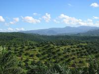
8 Percent of World's Remaining Pristine Forests Degraded Since 2000

  • agriculture
  • deforestation
  • forests
Forest fragmentation is caused by the expansion of logging, mining and development activities. Photo credit: Angela Sevin, Flickr
  • agriculture
  • deforestation
  • forests

High-Resolution Satellites Help Monitor and Respond to Fires in Southeast Asia

  • deforestation
  • forests
  • Global Forest Watch (GFW)
  • Indonesia
  • Indonesia forest fires
Forest fire in Indonesia. Photo Credit: CIFOR/Flickr
  • deforestation
  • forests
  • Global Forest Watch (GFW)
  • Indonesia
  • Indonesia forest fires

New Study Shows Indonesia Losing Primary Forest at Unprecedented Rates

  • Climate
  • deforestation
  • forests
  • Indonesia
Indonesia lost more than 6 million hectares of primary forest from 2000 to 2012. Photo credit: Rainforest Action Network, Flickr
  • Climate
  • deforestation
  • forests
  • Indonesia

New Palm Oil Production Maps Mark a Milestone in Transparency

  • deforestation
  • forests
  • maps
  • palm oil
  • transparency
Most palm oil comes from Indonesia and Malaysia. Photo credit: Achmad Rabin Taim/Wikimedia Commons
  • deforestation
  • forests
  • maps
  • palm oil
  • transparency

4 Ways GIS Mapping Can Empower Forest Communities in Indonesia

  • deforestation
  • forests
  • Indonesia
  • Indonesia forest fires
Our trainings in Indonesia revealed four clear benefits of GIS mapping. Photo Credit: WRI
  • deforestation
  • forests
  • Indonesia
  • Indonesia forest fires
Insights

Struggles in East Kalimantan Underscore Need for Better Access to Environmental Information

  • Access Initiative
  • access to information
  • access to justice
  • Indonesia
More than 70 percent of Samarinda's land is allocated to mining concessions. Photo credit: CIFOR/Flickr
  • Access Initiative
  • access to information
  • access to justice
  • Indonesia

FORMA: A Near-Real Time Alert System for Tropical Forest Loss

  • Climate
  • deforestation
  • forests
The FORMA team, which started at the Center for Global Development and moved to the Data Lab at WRI, was inspired by the DETER and SAD forest monitoring systems covering the Brazilian Amazon. Photo Credit: CIFOR/Flickr 2011
  • Climate
  • deforestation
  • forests