Making Big Ideas Happen

Resources

Type of Resource

Tags

Mapping, Management, and Mitigation: How Peatlands Can Advance Climate Action in Southeast Asia

  • climate
  • Indonesian Peat Prize
  • Mapping
  • peat
  • peatland
Despite playing a major role in climate action, peatlands have been deforested and drained for agricultural lands. Photo credit: Nanang Sujana/CIFOR
  • climate
  • Indonesian Peat Prize
  • Mapping
  • peat
  • peatland

Collaboration on Nature-Based Solutions is Key to Resilient City Infrastructure

  • sustainable cities
  • sustainable cities initiative
  • urban development
Departments that work together on projects and use natural infrastructure, like the Bishan-Ang Mo Kio Park in Singapore, can achieve a variety of benefits. Photo by Stefano/Flickr.
  • sustainable cities
  • sustainable cities initiative
  • urban development

4 Benefits of Participatory Tree Mapping for Jakarta's Development

  • Cities & Transport
  • cities
  • green infrastructure
  • low carbon cities
  • sustainable cities
Pepohonan di tengah kota Jakarta. Kredit foto: ssopian88/pixabay
  • Cities & Transport
  • cities
  • green infrastructure
  • low carbon cities
  • sustainable cities
Insights

Responding to Coronavirus: Low-carbon Investments Can Help Economies Recover

  • coronavirus
  • low carbon
  • low carbon cities
  • low carbon development
Taking bold climate action, such as increasing renewable energy capacity, can stimulate economic growth while reducing air pollution. Photo by Hahaheditor12667/Wikimedia Commons
  • coronavirus
  • low carbon
  • low carbon cities
  • low carbon development
Insights

Personalizing Carbon-Footprint from Our Travels to Mobilize Climate Action

  • Cities & Transport
  • cities
  • low carbon
  • low carbon cities
Different transport systems and use pattern lead to different emissions and offsetting potentials.Photo credit: WRI Indonesia
  • Cities & Transport
  • cities
  • low carbon
  • low carbon cities

The World Lost a Belgium-sized Area of Primary Rainforests Last Year

  • deforestation
  • Global Forest Watch (GFW)
  • Mapping
Primary rainforests are critically important for storing carbon and providing habitat for jaguars, orangutans, gorillas and other animals. Photo by stokpic/Pixabay
  • deforestation
  • Global Forest Watch (GFW)
  • Mapping
Insights

IPCC 1.5° Report: We Need to Build and Live Differently in Cities

  • Cities & Transport
  • cities
  • climate change
  • IPCC
  • low carbon cities
Wiping down rooftop solar panels in Mumbai. Flickr/The Climate Group
  • Cities & Transport
  • cities
  • climate change
  • IPCC
  • low carbon cities

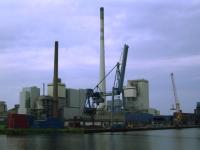
Power Plants Use Water, But We Have No Idea How Much

  • Climate
  • coal
  • Mapping
  • oil and gas
  • water
  • water risk
  • water stress
  • Climate
  • coal
  • Mapping
  • oil and gas
  • water
  • water risk
  • water stress

Integrating Public Transport Networks to Overcome Jakarta Traffic Congestion

  • cities
  • sustainable cities
  • sustainable cities initiative
  • transportation
  • cities
  • sustainable cities
  • sustainable cities initiative
  • transportation
Insights

Visualizing a Warmer World: 10 Maps of Climate Vulnerability

  • adaptation
  • climate change
  • local impacts
  • Mapping
  • adaptation
  • climate change
  • local impacts
  • Mapping
Life at WRI Indonesia

Women and 3D Mock-Up

  • Climate
  • forests
  • gender
  • Mapping
  • Life at WRI Indonesia
  • Climate
  • forests
  • gender
  • Mapping
  • Life at WRI Indonesia

5 Maps Show How Important Indigenous Peoples and Local Communities Are to the Environment

  • Forests & Land Use
  • Climate
  • deforestation
  • human rights
  • indigenous people
  • land rights
  • land tenure
  • Mapping
  • Forests & Land Use
  • Climate
  • deforestation
  • human rights
  • indigenous people
  • land rights
  • land tenure
  • Mapping

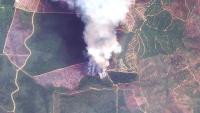
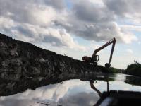
Places to Watch: 5 Forests at Risk This Month

  • deforestation
  • forests
  • Global Forest Watch (GFW)
  • Mapping
  • deforestation
  • forests
  • Global Forest Watch (GFW)
  • Mapping

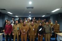
3 Ways Governments Can Prevent Fake Data on Forests

  • data
  • deforestasi
  • deforestation
  • forests
  • Indonesia
  • Mapping
  • data
  • deforestasi
  • deforestation
  • forests
  • Indonesia
  • Mapping

Opposing a Contempt of State with One Map

  • forest
  • Mapping
  • forest
  • Mapping
  • deforestation
  • forest
  • Mapping
  • water
  • water risk
Insights

As Indonesia’s Dry Season Looms, a New Tool Can Predict Daily Forest Fire Risk

  • agriculture
  • deforestation
  • forest
  • Indonesia
  • Indonesia forest fires
  • Mapping
  • agriculture
  • deforestation
  • forest
  • Indonesia
  • Indonesia forest fires
  • Mapping

Destruction of Tropical Peatland Is an Overlooked Source of Emissions

  • agriculture
  • deforestation
  • degraded land
  • Indonesia
  • Mapping
  • maps
  • palm oil
Peat drainage canals, combined with fire, are used to make land more suitable for agriculture. Photo by Nancy Harris/Flickr
  • agriculture
  • deforestation
  • degraded land
  • Indonesia
  • Mapping
  • maps
  • palm oil
Insights

When Could the Paris Agreement Take Effect? Interactive Map Sheds Light

  • climate
  • climate data
  • COP21
  • international climate policy
  • Mapping
  • maps
  • Paris Agreement
  • UNFCCC
The Paris Agreement Tracker enables people to monitor countries’ progress toward ratifying the Paris Agreement, and allows users to create their own combinations for bringing it into force.
  • climate
  • climate data
  • COP21
  • international climate policy
  • Mapping
  • maps
  • Paris Agreement
  • UNFCCC