Resources
December 20, 2021
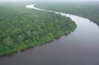
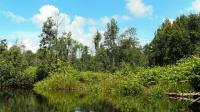
Our Forest Management After COP26
January 30, 2021
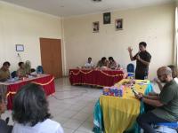
Improving the Lives of Indigenous Communities through Mapping
September 21, 2020
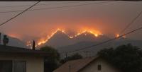
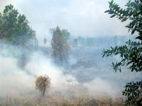
6 Graphics Explain the Climate Feedback Loop Fueling US Fires
![Bobcat Fire, as seen from Monrovia, California. Photo by Eddiem360/Wikimedia Commons](/sites/default/files/styles/150_tall/public/bobcat-fire-los-angeles-san-gabriel-mountains_0.jpg?itok=r9nMxNO4)
December 11, 2018
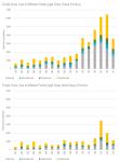
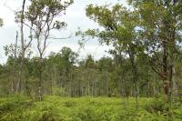
Forest Cover Loss in Different Forest Legal Class, Papua
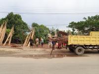
![](/sites/default/files/styles/150_tall/public/papua%20and%20west%20papua.jpg?itok=eLM_8UO5)
July 18, 2017
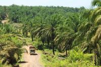
Land and Social (In)justice in South Sumatra
![](/sites/default/files/styles/150_tall/public/oil_palm_plantation.jpg?itok=IkYJ7Nlq)
June 21, 2017
Can “One Map” Solve Indonesia’s Land Tenure Woes?
![](/sites/default/files/styles/150_tall/public/adi_and_gita.jpg?itok=UZHI6uYa)
June 19, 2017
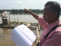
Conflicting Maps Leave Some Indonesian Farmers Landless
![](/sites/default/files/styles/150_tall/public/saad-musi-river.jpg?itok=wpbWkagl)
February 16, 2017
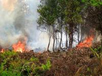
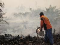
Exploring Indonesia's Long and Complicated History of Forest Fires
![](/sites/default/files/styles/150_tall/public/14416550936_fc32f97b9f_z_1.jpg?itok=EQQc12wR)
December 28, 2016
How Indonesia is stepping up fight against climate change
![](/sites/default/files/styles/150_tall/public/indo_fire_0%20%28photo%20by%20Rini%20Sulaiman%20-%20Norwegian%20Embassy%20for%20CIFOR%29.jpg?itok=3ynoyWsP)
April 22, 2016
Spatial Planning for Low Carbon Development in Indonesia
![](/sites/default/files/styles/150_tall/public/Forests%203.jpg?itok=IP5ZVYwj)
September 24, 2015
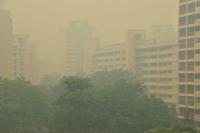
Indonesian Fires Create “Hazardous” Levels of Air Pollution in Singapore
![Singapore during the 2013 haze crisis. Photo by Choo Yut Shing/Flickr.](/sites/default/files/styles/150_tall/public/9098810108_f3f6c5fb3a_z.jpg?itok=cEwIcCPt)